In 2024, Lisa Pruitt, a friend who is a professor at UC-Davis, asked whether I could help with creation of a map of the state of Washington to illustrate some research she was working on with two other researchers. They were documenting procedural fairness in six rural counties, shown here in red, and comparing them to six metropolitan counties, shown in blue.
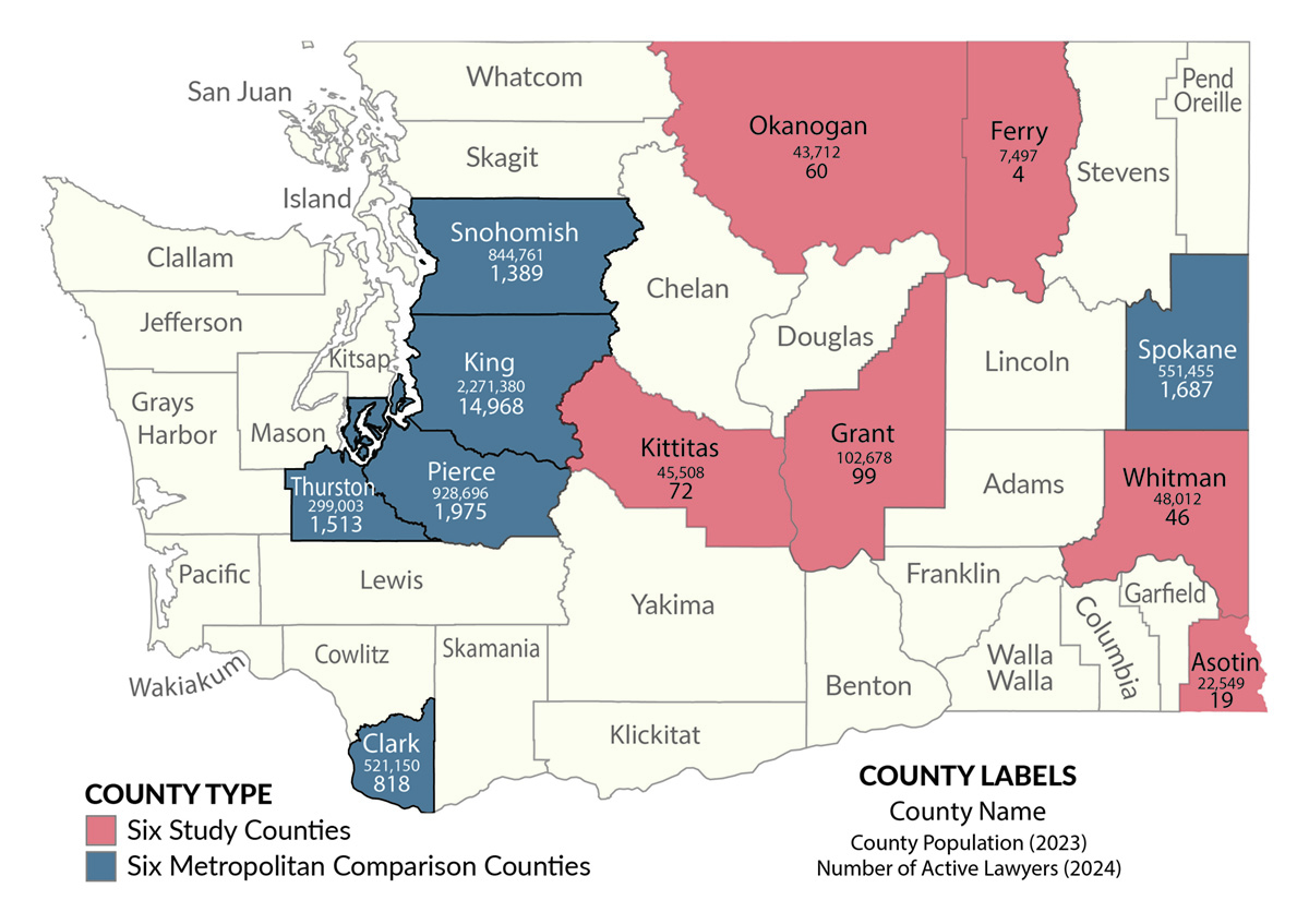
In essence, most of the rural study counties studied had very low numbers of practicing attorneys, some so small that the residents of the county effectively had no consistent legal representation, taking into account all the legal specialties needed.
Their article and the above map were published in the Yale Law Journal in March 2025.
Lisa and I talked about what she wanted to convey with the map and what I thought I could provide. I bounced ideas off of her, one as simple as switching from the B&W map that had initially been proposed to a color map to make it easier to identify the six rural and six metropolitan counties. She checked with her editors to see if color would work and received a “yes” in reply. So we went that direction.
She did want to keep the non-studied county names to help people in Washington relate their home county to the studied counties, but we softened their colors to keep them in the background.
I also debated whether to make the studied county colors shift in intensity — light red to dark red, for instance — depending on the number of attorneys per capita in each county. That data was also being presented in tables with exact numbers, so ultimately we stuck with using the color just to show the major split between rural and metro.
